Globe, Maps and Their uses
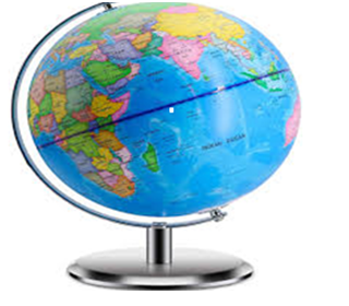
Globe: If we draw an
accurate map of earth on a round body like a football, it will become a model
of the earth. It is called globe.
Map: Map Is a
representation of the whole earth or part of it on a flat surface
(paper) according to a given scale.
Globe is round
and map is flat.
Globe
represents the whole earth while map can
represent a small portion of earth.
Maps are drawn
on the basis of directions. East, West, North, and South are primary
directions. These are called cardinal points.
There is four
more direction between the cardinal points. These are called secondary
direction.
Types of North: 1) True North 2) Magnetic North
True North: It is also called geographic North. And we find this
side on the help of the star
and shown on map arrow.
Magnetic North: Our earth has
a magnetic field and like a magnetic bar it has two ends i.e. magnetic North
and magnetic South. Magnetic North can be traced by an instrument known as magnetic
compass.
Magnetic north is situated near
North Pole in the Canadian island of prince Wales.
Scale: A ratio is
established between ground and map distance is called scale. (1m=1cm)
Types of scale: 1) Statement of
scale 2)Representative Fraction 3)
Linear scale
Statement of
scale: As a statement i.e. 1cm=1metre this is called statement of scale.
Representative
Fraction: In this type the scale is
expressed as fraction, e.g. If 1/10,000 or 1:10,000 means that a unit distance
(cm) of the map represent 10,000 units (cm) of the ground.
Linear scale: It is also
called plain scale. It is a line of suitable length given on the
map and is divided into equal distance.
Longitudes: Lines on the globe
drawn in North – South directions are called longitudes.
Prime meridian: The
central line is on zero (0) degree and called Prime Meridian.
Latitudes: Parallel lines have been drawn
on the globe from east to west is called latitudes. These degrees
are 180 in number (90 degree northern latitudes and 90 degrees
southern latitudes.
Equator: It is 00.
The central line between the latitudes lines which
divides the earth in to two equal parts is called equator.

Tropic of cancer (خط سرطان): This line is located
at 23
Tropic of Capricorn (خط جدی): This line is located
at 23
Arctic line (دایرہ قطب شمالی): Arctic line is located in the north
of equator at 66
Antarctic Line (دایرہ قطب جنوبی): Antarctic line is located in the south
of equator at 66
Pakistan’s time
is 5 hours ahead (+5) of London.
Earth rotates
from west to east.
Greenwich Mean Time GMT:
The time is determined from prime meridian or 0
longitudes.
The time is determined from prime meridian or 0
longitudes.
The countries which are located to the East
of zero longitude (Greenwich) are ahead of the Greenwich Mean
Time.
The countries which are located to the West of
Greenwich are behind the Greenwich Mean Time.
There is a difference of 4 minutes between two
longitudes.
International
dateline: It passes along the 1800 meridian. It is
called date line because day in the world starts
from this line.
Methods of
showing relief of earth on map: 1) Contour line 2)
Layer tints
Contour line: Contours are
drawn to show altitude on the map. “These are lines on the map
which joins areas of equal height from the sea level.
Layer Tints: Different
areas are shown by different color layers e.g. plains and
forest is shown by different shades of green color,
mountain by brown and snowy by white
color.
MCQs .
Model of the Earth is called………………..
a) Map
b) Globe
c) Scale
d) none
Which of the following we use for detailed study
of the earth?
a) Map
b) Globe
c) Scale
d) none of these
Which of the following is/are the components of a map?
a) title, direction
b) scale, symbols
c) longitudes and latitudes
d) all of these
Each map has a title which show/s………
a) name of area
b) purpose of map
c) both a and b
d) none of these